Blog
From the Collection
June 29, 2023
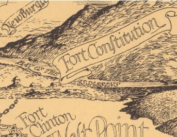
A section of a pictorial map of West Point, c.1778-1780, printed in 1943 by Des Rosiers, displaying what is now known as Foundry Cove as the “Bay of the Assassins.”
Bay of the Assassins
by Edward Bauer
About the author: Throughout the month of May, we welcomed Edward Bauer as this year’s Haldane Senior Intern. Bauer inventoried our extensive local map collection (over 300 items) and identified a selection of maps for further research. Detailed below is he look into the local “Bay of the Assassins.”
(Above) This map depicts West Point and surrounding areas, as they were during the American Revolution, with information on the area’s importance in the war and the various Revolutionary landmarks that line the river: the Great Chain, Fort Constitution, various redoubts, and others often cited in the Hudson River’s history.
However, immediately to the north of Constitution Island, where Foundry Cove is located, there is instead the name “Bay of the Assassins.” This choice of name jumped out at me immediately. Curious as to why it would be called that, I went to look it up, but found nothing on the topic. This is when I decided I ought to do some digging on the matter.
When I search “Bay of the Assassins” in quotations alongside “West Point,” I found a book called West Point: A Bicentennial History by Theodore J. Crackel. On page 20, there is a map from the United States Military Academy’s Department of History depicting defenses at West Point c.1779-1780. On this map, the same spot is labeled “Bay of the Assassins.”
Prior to finding this map, I feared that the person who made the first map I found in 1943 simply decided to call this seemingly random spot the Bay of the Assassins in order to make it sound more interesting. However, now that there is another source to corroborate this title, from the very same institution that the map depicts, I am far more hopeful that there may be a story of interest behind this name.
I will have to continue to seek information on this title; I plan to get in touch with the United States Military Academy’s Department of History to see if they have any answers. Their map is depicted below.
Do you have information on the Bay of the Assassins? We would love to learn more!
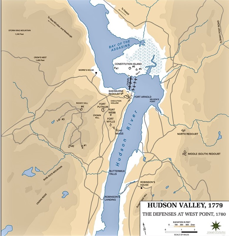
The United States Military Academy Department of History’s Map of the Defenses at West Point, c.1779 to 1780. The Bay of the Assassins is present to the north of Constitution Island.